The things you find on the Internet...
https://maps.lib.utexas.edu/maps/imw/txu-oclc-6654394-nl-41-2nd-ed.jpg
University of Texas has scanned topographical maps obtained or produced
by US army.
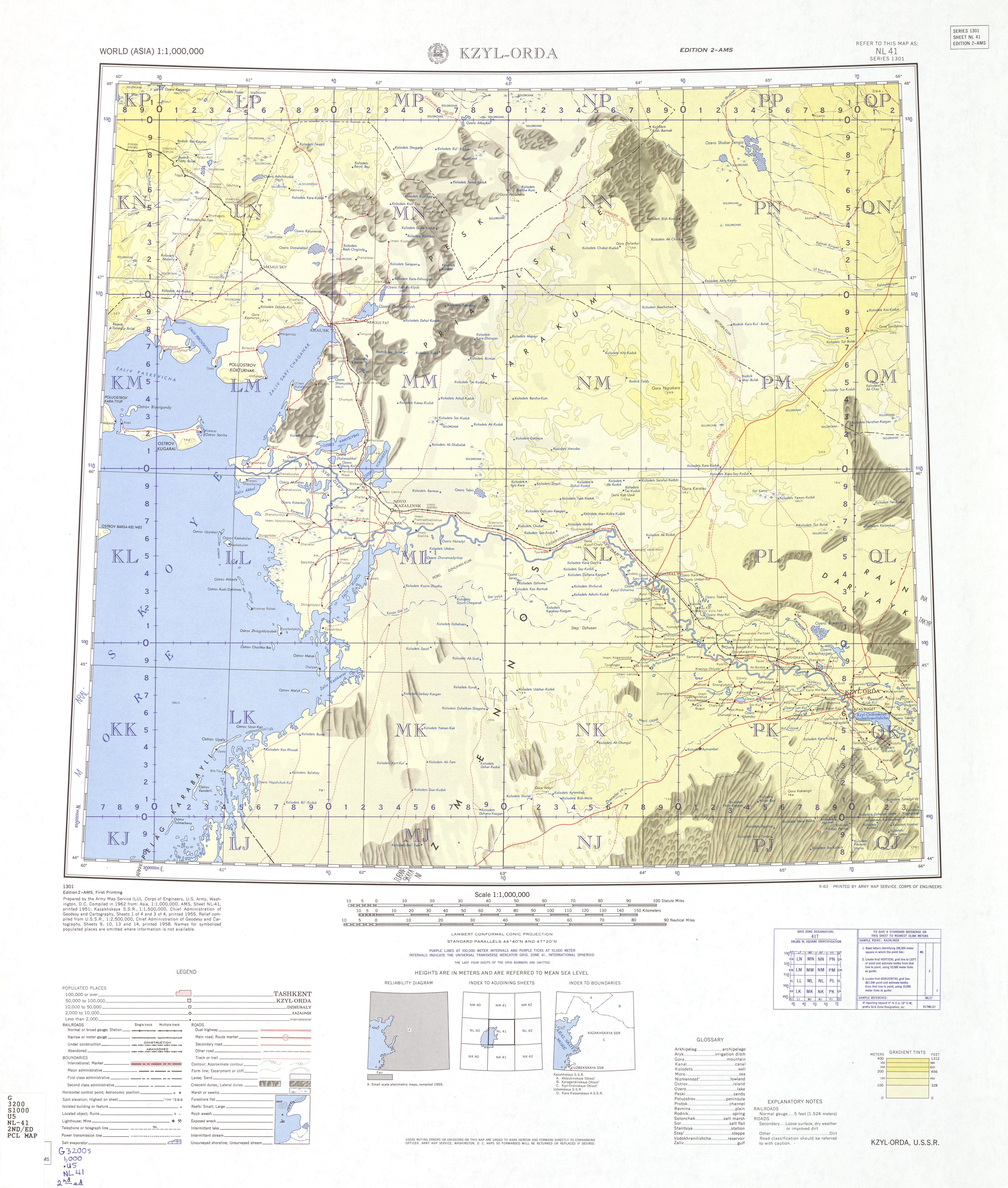
The above image is the US Army idea of the part of Kazakhstan circa 1962.
Baikonur townsite is where Tyuratam is on KAZAKHKAYA railway. The
launch site is alsmot due north of town site. The US Army map doesn't
even show a road heading north of town site.
Prior to COVID anmy tourist could just go there and take pictuires and
its location is on Google maps. Pretty amazing h something so screte in
the 1960s is today such a no brainer.
(how I got it:
https://maps.lib.utexas.edu/maps/topo/
click on "World Google Earth Map Index. This is a kmz file that loads on
Google Earth. You clck on iceon in middle of each tile, this pops up
small dialogue for that map and right click to copy lilnk, then open
image in browser, copy and put it into Photoshop so you can zoom in/out
easily.
--- SoupGate-Win32 v1.05
* Origin: fsxNet Usenet Gateway (21:1/5)